

Sitting on the slope of a windy ridge at an altitude of about 3800 meters, I reflected on my path through life that has brought me to this idyllic moment. Not that it was a very comfortable place to relax after a hard day’s trek. The ground, composed mainly of loose scree, sloped down at about 30 degrees under us and the heavy rucksacks on our backs further affected our balance. The soil shifted under our weight and we had to adjust continuously to prevent slipping down the ridge face.
Our guide, Mannu Rawat of Mana village, was rather impatient as the afternoon sun was moving slowly but steadily towards the west and we had a few more kilometers to cover to reach our camping spot of Chakratirtha. What kept us waiting was our porters who were taking a few minutes of rest in the grassy meadow that we crossed about a kilometer back. They were supposed to catch up with us by now but sitting on that high point we could not locate any sign of them across the meadow below us.
We could not move down the ridge to the other side as we would lose the view altogether and in case they have been delayed by some unforeseen issue that would not be the ideal thing to do. Minutes ticked away from 15 to 20 and a few frustrated blows in the whistle of our guide yielded no response. Finally, he dropped his rucksack at a proper spot and decided to trace back to find what was wrong.
So, three of us saw him going down the slope, down, further down and then getting smaller and smaller across the meadow and ultimately vanishing. However uncomfortable the spot was for sitting, we were compensated amply by the spectacular views all around us. On the right, the snowy flanks of the Neelkanth and Parvati peaks shone majestically under the afternoon sun and the multiple peaks that raised their snowy flanks along the borders of the Satopanth glacier guarded our left.
The glacier itself was hidden from our view with a high wall of moraine. The bowl-shaped meadow at the Neelkanth Base camp stretched away below us in a vibrant expanse of green and grey. In the direction of our trek, the mighty Chaukhamba stood like a wall of snow through the veil of afternoon clouds. We sat in total silence engrossed with the views all around us and after some time the sun got hidden behind a few clouds.
It was as if the wind was waiting for that moment to bite down with its icy teeth and we felt real cold for the first time during the day. The top of the ridge was facing the full force of the wind and at the altitude, it started getting uncomfortable. Minutes passed and we were contemplating whether we should move down the ridge to the other side. After about fifteen more minutes, to our relief, we located three minuscule figures walking towards us across the meadow.
Ultimately, the group came up with the porters looking rather sheepish. We learned that they had simply fallen asleep under the warmth of the sun, hence the delay. Being caught in the act of taking a nap during working hours by the boss is extremely embarrassing for even the best among us. Our guide had given them quite a thrashing and we laughed at the whole incident and moved ahead.

Our memories determine the kind of human beings that we are and what we carry as the content of our minds. Out of the millions of threads that we have collected throughout our lifetime, some threads shine like gold. My trek to Satopanth Tal is almost a decade old but it remains engrained in my mind as one such memory. It all started with our fascination with the mythical area around Kedarnath and Badrinath directed our path to Satopanth Tal, a sacred lake in the Garhwal Himalayas of Uttarakhand.
The entire route to Satopanth tal is associated with myths from the Mahabharata and is marked as the path taken by the Pandavas for their last journey towards heaven. As the four brothers and their wife Draupadi gave up their lives on the path, it was the eldest brother Yudhistira, who alone was able to reach the final destination. Legends also speak of the holy trinity, Brahma, Bishnu, and Maheswar, who meditated at the three corners of this triangular lake.
It is also a route involving some remarkable mountaineering expeditions, including that by the legendary explorers Eric Shipton and Bill Tilman in 1934. There were other expeditions after that and some of them explored the existence of a route between Badrinath and Kedarnath as per the ancient legends of a priest offering puja in both temples in one day. Stories about secret tunnels that once existed between the temples still float around among the locals. There were also various expeditions for climbing of Chaukhamba and Neelkanth via this route by various mountaineers.

Our adventures started in the town of Joshimath itself, with the struggle to cross the bureaucratic hurdles in search of an Inner Line Permit. I had been to Joshimath earlier and having witnessed the flow of millions of pilgrims towards Badrinath for centuries, the place has not changed much through the ages. At present, it is a lot cleaner than it used to be a few years back. The town, guarded by high mountain ranges on all sides, with the narrow and dusty NH 58 moving through it like an artery and lined by a variety of shops, is a major hub for mountaineers and trekkers for this part of Garhwal.
We started the morning with a trip to the Forest Department’s office which is on the upper part of Joshimath. Now there, we faced a lot of queries and were asked to provide the details of our guides and porters and their photos, etc. which was simply impossible. After contacting our guide who spoke with the responsible officers, we somehow managed to get a permit after paying the fees. We thought that the worst part was over but the day had a lot more fun in store.

Armed with the forest permit we came down again to the DM’s office and met the SDM. To our shock, the SDM was absolutely reluctant to grant us a permit, especially due to the death of a few porters and subsequent rescue operations that took place in the Kalindi khal route, the previous month. Her view was that the area is risky and with the present weather conditions being unpredictable the Government cannot permit any further trekking groups. We stated clearly that our route was quite different from that of Kalindi Khal and does not go near the Chinese border. But she was reluctant to take any risks.
The best piece of information we gathered from her was that as per the government rules, no group of less than four heads can go for a trek and as we were a team of three, she instructed us to find another person to join our group. It was apparent that since the state officials faced a lot of trouble along with embarrassment in the media about the accidents last month, they were unwilling to take any further risks. At one point I thought of leaving the office and attempting the trek without the permit.
After a lot of reasoning, coaxing, and trying our best to convince her, we ended up signing an affidavit, which basically stated that we were willing to risk our necks in the trek and would be responsible for all consequences. This piece of document finally managed to get her valued signature and stamp against our photos on an inner line permit. Comparing bureaucratic standards, the other officials were very cooperative and at last we emerged weary but victorious, with the permit in our hands.
For me, that morning’s work seemed more strenuous than the trek itself. Today I can look back and sympathize with her, knowing that most of us in some way or the other always want to safeguard our own backs, especially in the professional arena.
Bemused but ready with our permits, we happily boarded a shared vehicle to Badrinath, met with our guide and spent a comfortable night in the holy town. The next morning, a bright and sunlit one, found us in Mana village with our support team, and without any further delay we started on the trek by crossing the Bhim pool over the Saraswati River. There were no inquiries or checks regarding our permits which, after all the effort we put in yesterday, should have rather disappointed us. But the bright weather and the prospects of the adventurous trek ahead had put our minds in too jubilant a mode to think about such trivial issues.
Mannu Rawat led the way and two young porters he arranged followed us with the tents and rations. We crossed the Alakananda over a makeshift bridge as the permanent bridge was washed out last year and climbed up on its true right bank. The path moved along the village cultivation grounds where the village men and women worked, growing mainly potatoes. The path passed along a small temple, that of Devi Anusuya, which is worshipped once every year.
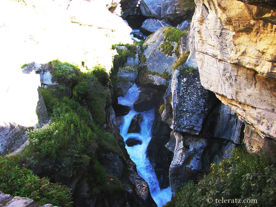
It then narrowed down with thorn bushes tugging aggressively at our clothes from all sides. There was a landslide zone that came next, with a small stream coming down from the right to join the Alakananda, and the loose ground hanging precariously over the foaming river. We crossed it without any trouble and saw the Vasudhara falls on the opposite bank. The strong winds literally make the water dance around in a white spray which refracts the sunlight to create a rainbow; a lovely sight to watch.

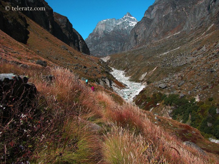
On our left the ground rose steeply, reaching another range of high ridges and mountains running parallel to the river valley. The valley curved away and in front of us and we could see some snow-covered peaks at a distance to our right beyond the Bhagirathi Kharak glacier which lay ahead of us, turning to a North West direction. We could not be sure of these peaks, but guessed them as Mount Swachhand. We took the first break for the day on the grass-covered ground enjoying the fantastic views.
Further on the path to Satopanth Tal moved over the meadows with autumn colours ranging from charming yellow to dull red. We crossed the pristine meadow of Chamtoli guarded by steep stone walls on the left. Another hour and half of trekking, a few more breaks and we reached the campsite at Laxmi Van where the Bangling glacier came down steeply to meet the Alakananda on the other bank, the true left side of the river.

Check out more trek and travel blogs on the website
By Suvajit Banerjee
© 2019 teleratz.com
