
“You guys took me for this trek as my first one… that too after saying that it would be relatively easy!” This was one of my friend’s reactions as he came back after completing the trip to Nandikund, which was indeed his first trek in the Himalayas. Treks to high-altitude Himalayan lakes have always been fascinating for trekkers for their pristine beauty. The view of a bluish-green water body which suddenly opens up to the eyes in the midst of the rocky and snowy vistas, has an almost trance-like effect on the mind.
Our original plan to visit ABC in Nepal got cancelled that year for some reason and we finally zeroed in on the Nandikund trek, primarily because it seemed more secluded and off the beaten track. But we definitely underestimated the route which is quite strenuous, especially for first-timers. Years later, when I look back, it remains an enchanting memory as the Himalayas opened up a new chapter of its wilderness in front of our eyes. We never imagined that the journey to a lake would take us through another valley of flowers where foaming rivers make their way through meadows covered in multiple hues.
When we planned for our Nandikund trek back in 2008, we could find only a few accounts available about the route. However, it seemed to have all the ingredients for which we trek the Himalayas. The path starts from the standard trek route to Madhya-Maheshwar in the Garhwal Himalayas, which is one of the five sacred temples of Lord Shiva. From Madhya-Maheswar, the path crosses Kanchni Khal and reaches the meadow of Pandavsera. A steep climb from Pandavsera meadows takes one to the lake of Nandikund and from there the route advances further, crossing the Ghia Vinayak pass. Then with another two-day walk through lovely meadows, it reaches Bansi Narayan temple and then ends in Devagram.
Our trip was planned by keeping some other factors in mind hence we decided to retrace our route back from Nandikund to Ukhimath. Also, we were advised that crossing Ghia Vinayak in early October can be risky, because of the high chances of a sudden snowfall. So, one fine end September morning we started our trek from Ransi village, which is connected by road to Ukhimath, the winter abode of Kedarnath. The four of us were accompanied by another four porters and our guide Devendar. All of them were from Ransi village and all through the trek, they gave us superb support and company.
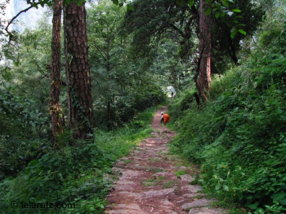
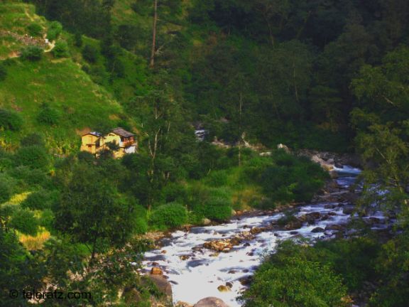
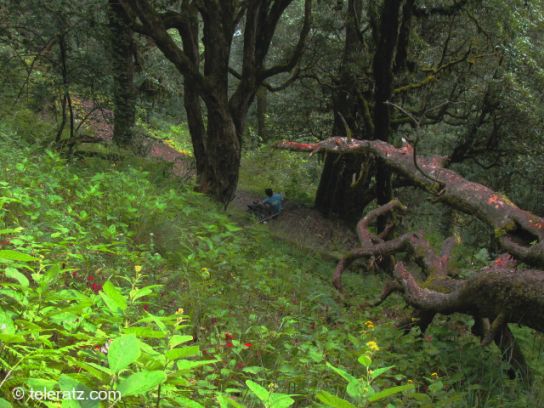
The route to Madhya-Maheswar is extremely scenic and for many of those who want to start trekking in the Himalayas, this can be an ideal first trek. The first day takes one through the forests with the path following the river to the village of Gaundar which is about 6 to 7 kilometers from Ransi. We crossed Gaundar and advanced another kilometer to stop at the small settlement of Bantoli located over a picturesque confluence. It is best to end the first day here, as the path ahead rises steeply across the mountain face and is best tackled the next morning with a fresh pair of legs.
The next day we trudged up the slopes with the weather turning misty, enjoying the coolness of the lovely path which rose up gradually. Apart from the Yatra season, which starts in May and continues for about five months, this path seldom sees much tourism. The silence of the forests here is only broken by the footfalls on the dry leaves that cover the ground. The path is well defined without any diversions so there is no chance of getting lost. We walked at a steady pace and reached the small village of Madhya-Maheswar in the afternoon.
The temple, one among the five Shiva temples in Garhwal, stood high in the green valley surrounded by high ridges. I will not repeat the story of Pandavas and Shiva as it is well known to most enthusiasts. The temple here is where the navel of Shiva emerged as his body came up in different places, each being the spot for a sacred temple. I learned later that the Shiva linga here is a powerfully consecrated Manipuraka linga.
The identity of those remarkable people who built these temples and consecrated them, without bothering to highlight their names in any way, we will perhaps never know. We live in an ancient land where facts and myths merge to develop a fascinating cocktail of spirituality; more so in the Himalayas.
It was my second visit to Madhya-Maheswar so the earlier route was familiar for me. I was rather daunted by the steep approach to Kanchni Khal which our guide showed us from Madhya-Maheswar. From below it seemed that the path was meant for four-legged creatures rather than two-legged ones. The real fun starts tomorrow, I thought.


The next morning we took the path and it started rising almost immediately through the ancient Pine and Deodar forests bordering the village. After an hour we could see the bird’s eye view of Madhya-Maheswar resting peacefully in the morning sunlight. This path has quite a history as many remarkable mountaineers and explorers have traveled over these exploring the area around Mount Chaukhamba and Panpatia glacier.
I remembered the account of legendary Bengali traveler and Himalaya lover Sri Umaprasad Mukhopadhyay who explored this area and visited the Bhairav temple which we reached a few hours later. We saw the remains of an army helicopter that had crashed in the area a few years back on the trail.


There was no respite from the steep climb and after taking a lunch break we moved ahead to reach the intimidating rock faces below Kanchni Khal. The area seemed to be a favorite haunt for bees with some huge hives hanging down the rock faces. Luckily none of them considered us a threat and we moved ahead without getting stung. The fog came in to blur out the world and we hopped and scrambled across the boulders and rocks to reach the top of the pass.
Another route to Kanchni tal, Sujal sarovar and Panpatia glacier, bifurcates from here. The pass gave a grand view of a wide range of snow-covered peaks, though the Chaukhamba range is not visible from here. The other side of the pass sloped down gently and we moved down fast to reach our campsite for the day on a rocky plain. The day’s walk had tired us down and it was not long before we laid our weary legs to rest inside our tents.


The next morning greeted us with a warm sunrise over the misty mountains. I stood outside with the camera and watched as a captivating scene unfolded in front of me. The light fell through the morning mists and the drifting clouds on a few peaks creating a radiating halo above them. Then, strangely, the light rays shifted and it suddenly seemed that the heavens had emptied a cauldron of molten silver over the two peaks in front of me.
It continued for some time and the mystical beauty unfolding in front of me left me speechless. The photos do not do justice to such a setting but a few are attached, which will give some idea of the phenomenon.


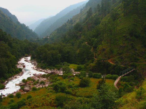
This day is another strenuous day for the trekkers on the path to Nandikund trek. The path moved across cliff faces like a narrow band cutting across the greenery, tracing the true right of the Madhya-Maheshwar Ganga. We crossed ridges one after another, going up and then coming down again with the trail sometimes losing itself in the undergrowth. I tried to count the total number of ridges we crossed but gave up in the end.
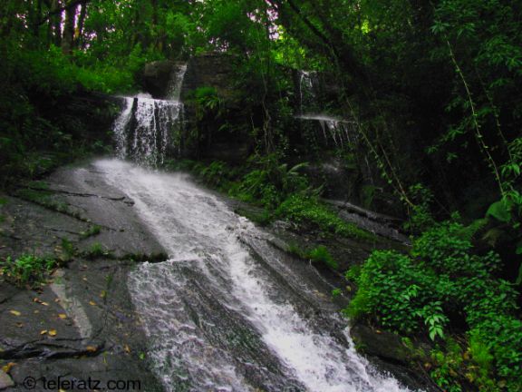
The path went across a mighty waterfall that roared down the mountain face flowing into the river on our right. The fog came again, engulfing everything in its embrace like a white blanket and all I could see at times was the person ten feet ahead of me with nothing beyond. A question of how much further always received the standard encouraging answer from our guide, “Just a few more ridges to cross.” Finally, when we came upon a ridge our guide pointed out the huge meadow of Pandavsera lying below us some distance ahead.


Legend of the Pandava brothers says that they spent a considerable period in this meadow during their exile period. Emerging from the floating clouds, the green slopes of the Pandavsera meadow with the river flowing through it looked inviting like a setting from an Indiana Jones movie and we took our steps down towards it. When we had set out for the Nandikund trek, we never knew what pleasant surprises nature had stored for us down there.
To be continued in the next travel blog...
By : Suvajit Banerjee
©-2018 teleratz.com

[…] more of our trekking travelogues here and […]
LikeLike
[…] The next day’s trail is steep as you need to cover almost 5000 feet of vertical distance to reach the Madhyamaheshwar temple. But the route is through the Kedarnath Wildlife Sanctuary and offers some splendid views. The final climb through forests will take you to the front of the temple clearing surrounded by high peaks. From here, there are trek routes to Panpatia Glacier and the high-altitude lake of Nandikund. […]
LikeLike
[…] Continued from part 1… […]
LikeLike
[…] out more trek and travel blogs on the […]
LikeLike